Wallingwood
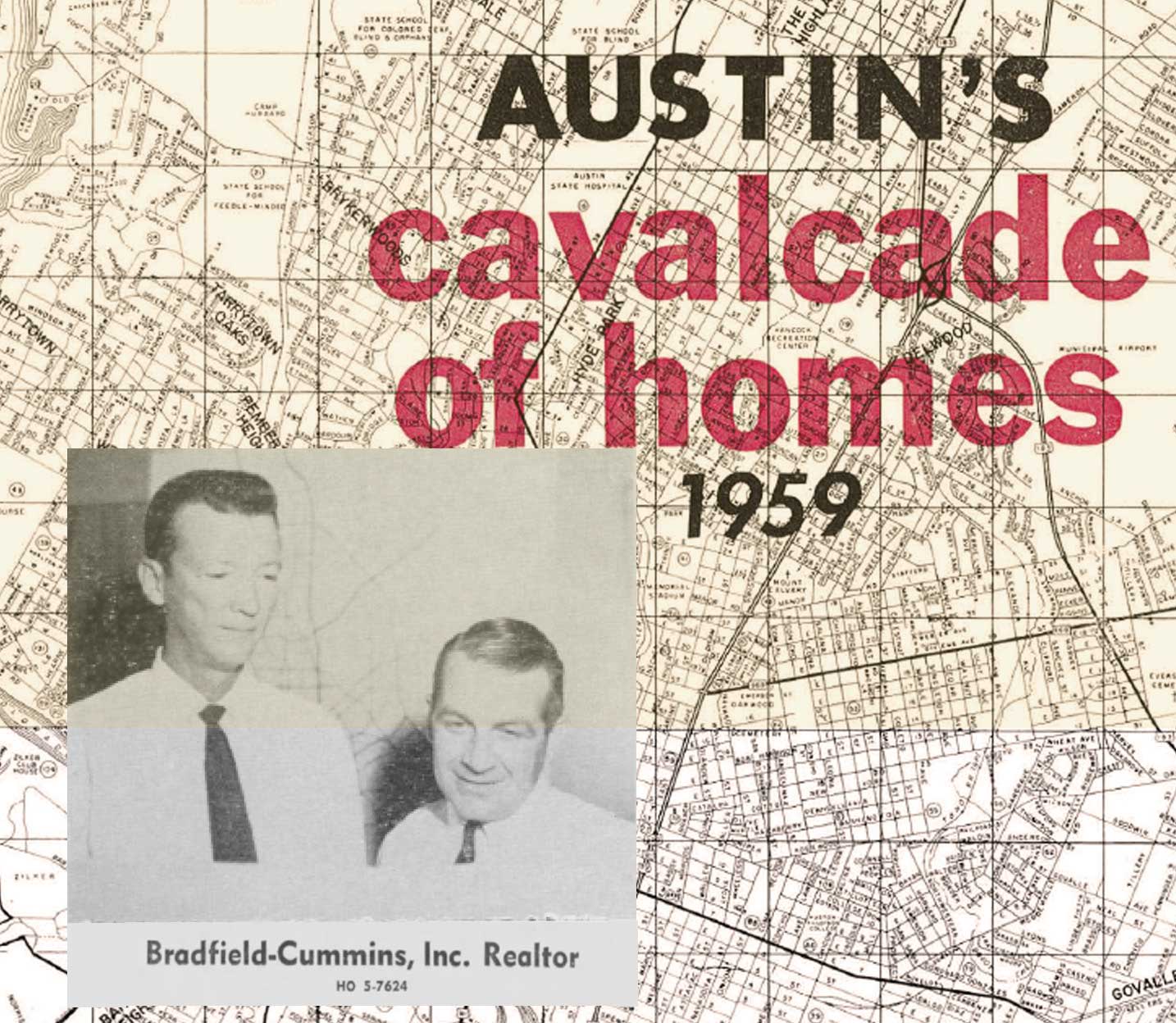
A Reflection By Mr. Don Cummins
Like much of the land along Barton Creek, the land along the west side of Barton Creek between Zilker Park and Loop 360 was originally part of the Delanna Ranch. In 1960 a group of investors, Bradfield, Cummins and Mueller purchased 434 acres from the Delanna family with plans to build a single family development, called Wallingwood. The tract of land purchased by these men would be at the heart of early environmental battles in Austin.
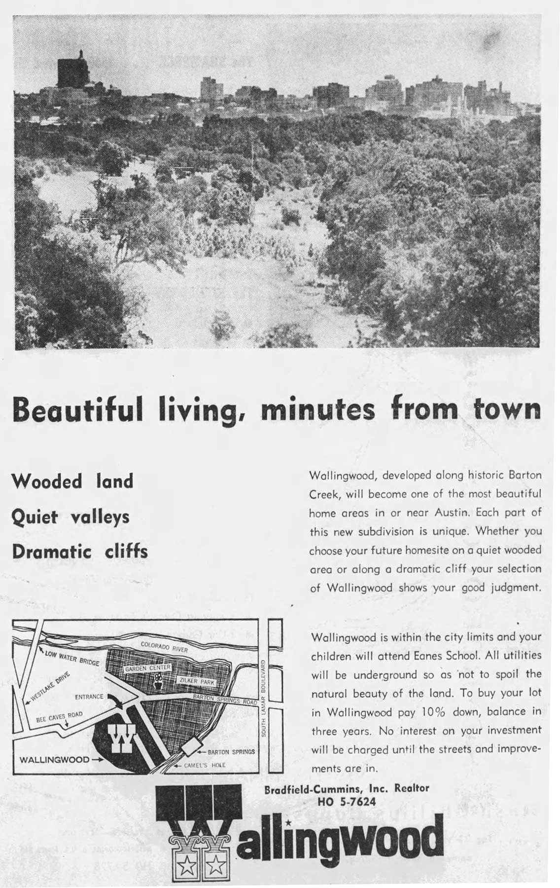
At first, the men planned to build single family homes. However, when the plans for Mopac (Loop 1) to cross the Colorado river (Ladybird Lake) materialized, the idea of building single family homes shifted to much denser development, including the apartment buildings and office space that we see today. The environmental community felt that dense development, including the laying of sewer pipes in the creek bed would pollute Barton Creek. While environmentalists succeeded in eventually bringing about stronger environmental controls, for the most part the developers achieved their goals to build offices and apartment buildings.
In 2015, Mr Cummins shared his perspective on this history with our team.
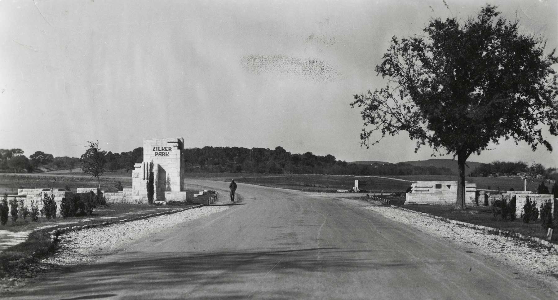
"In the early 1960s Zilker Park’s only road access was from a two lane humped- back road called Barton Springs, which as it curved westerly became known as Bee Cave Road, was later designated RM2244."

"While on Austin’s Master Plan there was a dotted line along the right-of-way of the Missouri Pacific Railroad, neither the City of Austin nor Travis county had funding for building out this road and Texas Highway Department thought it to be an Austin problem."

"A group of seven landowners in west and northwest Austin called Northwest Highlands Association began having monthly meetings cabling in personnel from the City, Travis County and the Texas Highway Department to keep alive the idea that a major expressway was needed for Austin. Finally in the Northwest Highlands meeting we had Mr. Jack Gubbels, former Texas Highway Department employee and the person who developed the periodic rest stations along Texas highways, who suggested that we needed an “origin and destination study” to prove up our thought that this road was possible. It cost $35,000, which our Northwest Highland organization paid for. This report showed the need for Mopac to run from U.S. 183 to U.S. 290 in order to service two growing areas."
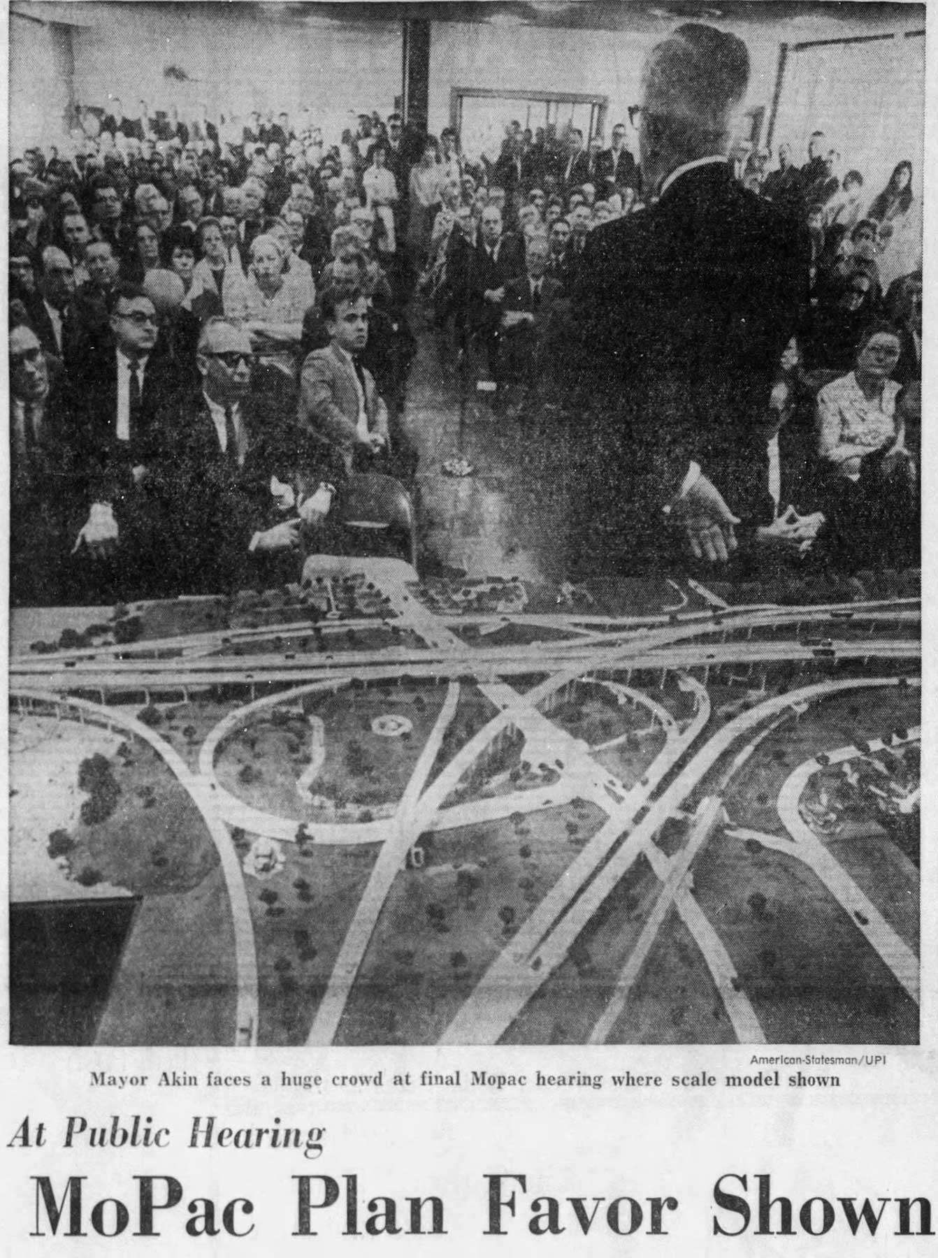
"This report gained attention of TX DOT (Texas Department of Transportation,) which then did its own study and adopted it as a major road project. A design was completed and federal funding was applied for and found that highway funds from the federal government had been impounded by the Nixon administration illegally. I researched the Federal Highway Trust Fund Act at UT law library, which stated that taxes from gasoline, diesel fuel, tires, batteries and motor oil sales going to the Highway Trust Fund must be used to build and maintain our major highway systems. Calling this to the attention of Representative J.J. Pickle (Democrat of Texas,) he then joined with Sentator Hollins to bring suit against the Nixon Administration to once again free up funding for road building."
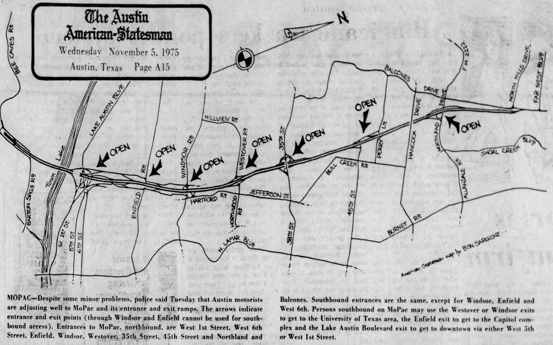
Map showing early Mopac exits. Notice that Mopac had not yet crossed Ladybird lake. The expansion of Mopac also paved the way for the development to the south and west of Austin.
"Thus, phase 1 of Mopac was built from 1st Street to just beyond Northland Drive, Phase 2 on to US 183, Phase 4 to extend across town like to FM 2244. Now we see the impact of Loop One on Austin as it expanded. Much of the reason that we now have a Loop One and 360 is our Austin Chamber of Commerce. Why so much information on Loop One? Its completion made it easier for West Austin citizens to have access to both Zilker Park and Barton Springs Pool."

"Land ownership along Bee Cave Road in the early days was ranches approaching 1000 acres. Such a landowner was the Charles Delanna family from whom we (Bradfield, Cummins and Robert Mueller) bought 434 acres in 1960 for what we visualized as a largely single-family residential development. One major problem at the time was that we didn’t have a large enough utility mains for water and wastewater to service a large area until the city bond issue provided funds for that project at Barton Creek. This was a good land sale for the Delanna family as it provided much-needed funds to help them keep the remaining land for future development – and ISD taxes were a burden for large ranch owners this was all in the days before Loop One was extended to Bee Cave Road."
"Bradfield, Cummins and Mueller found that there was demand for apartment development in the 1970s so we built Wallingwood Drive off of Bee Cave Road to accommodate the sale of apartment tracts. The City of Austin purchased 38.24 across of expansion of the Barton Creek Greenbelt which land we had planned as single family residential."
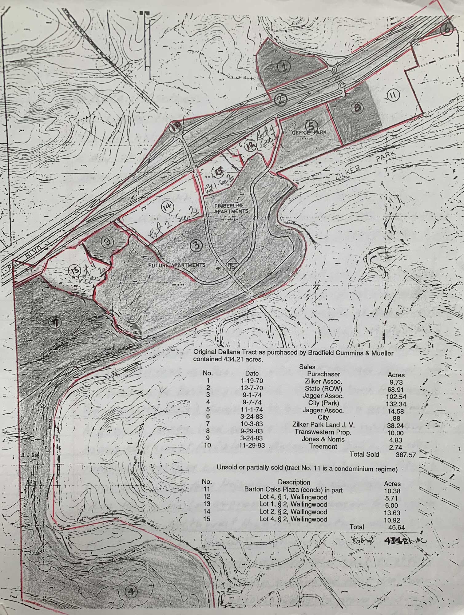
Map showing land sales of the land owned by Bradfield and Cummins.
"We began to see the demand for office zone tracts in the 1970s. We applied for zoning for our tracts fronting Loop 1 of “O” office zone only to be denied zoning. This caused us to bring a lawsuit against the City of Austin. State law says a landowner is entitled to “reasonable use” of their land. After several years of litigation, we reached a “compromise” settlement agreement, which gave us our desired “O” office designation for our tracts fronting loop one. In 1983 we then began to sell those tracts to office building developers. This caused the development of approximately 1,173,800 sq. ft. of office with frontage on Loop 1 between Barton Oaks and other tracts in Wallingwood. Much care was given to water pollution retention systems in order to preserve Barton Creek. We gave much attention to tree preservation and landscaping of those office tracts. We also sold one tract along Loop one for approximately 240,000 s.f. of apartments."